|
|
||
|
|
|
|
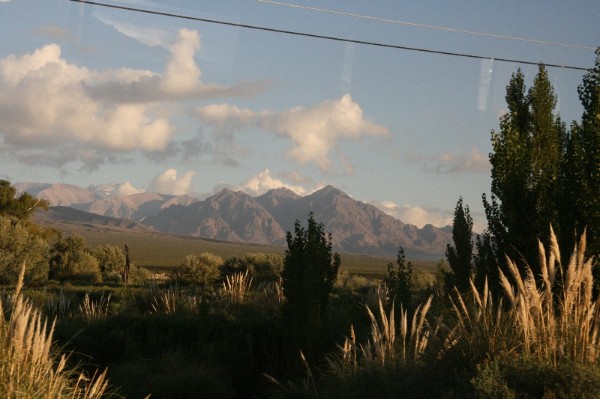
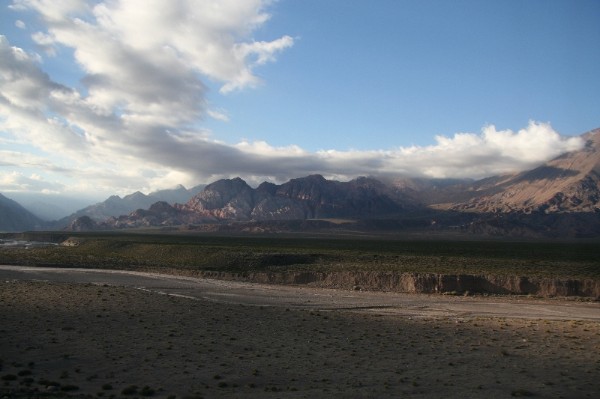
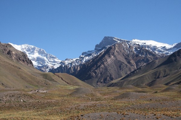
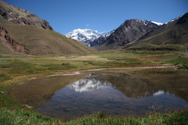
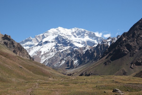
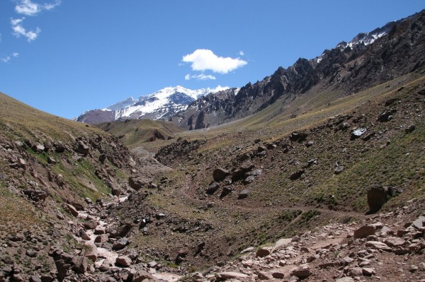
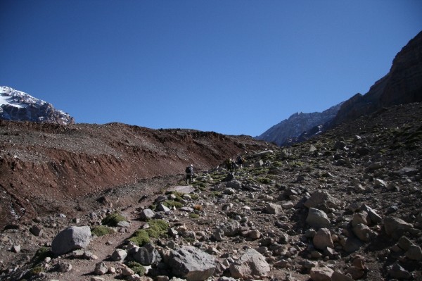
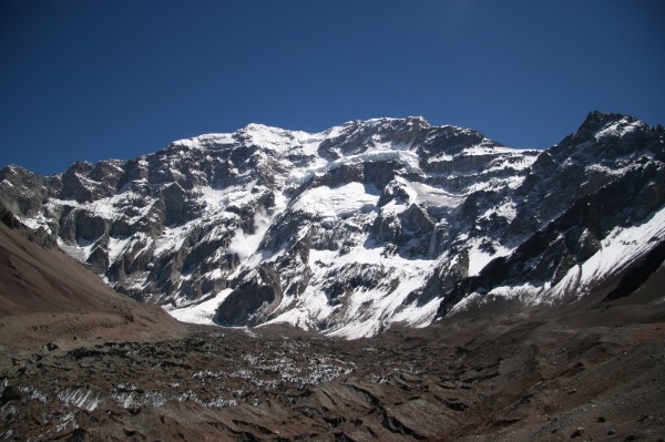
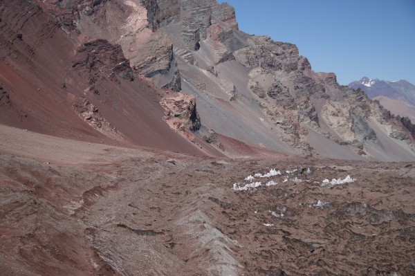
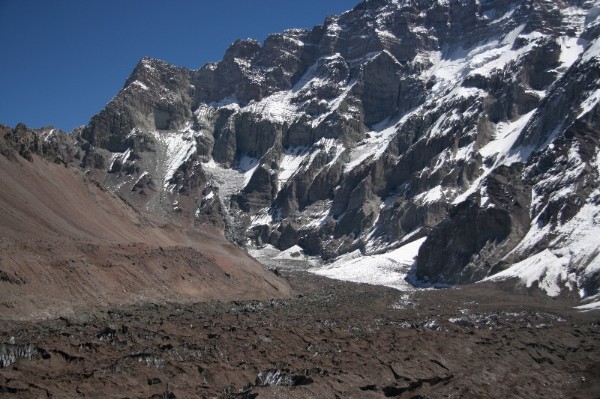
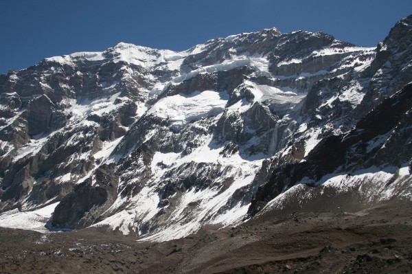
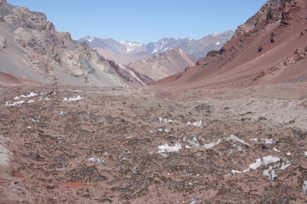
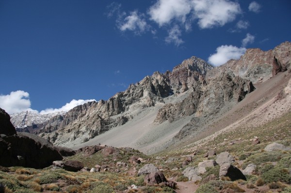
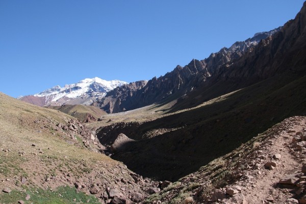
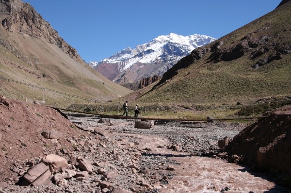
Once staying in Mendoza it is worth doing the three days trekking to the south face of Aconcagua, America’s highest peak at 6962 m. End point of the trek is Plaza Francia at 4200 m. Most trekkers however, whether individual or in group only walk as far as Mirador I (viewing point I), although it is worthwhile to keep on walking. It is necessary to point out that because they are lacking acclimatisation trekkers might experience high altitude sickness symptoms anytime. Keeping in mind that Mendoza is at only 750 m and that the highest point is reached only two days later, such reactions are not surprising.
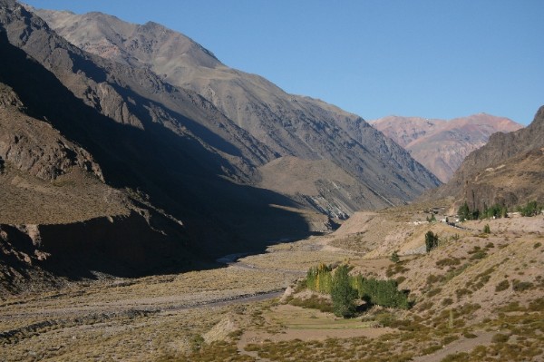
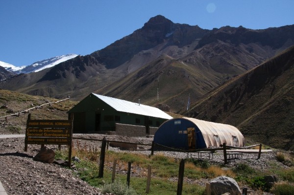
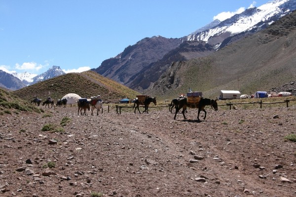
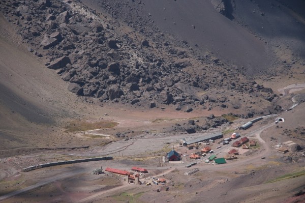
Traveling by bus it takes around four hours to the street junction to Horcones, from where it takes another 20 minutes walking to the park entrance at 2850 m. There you show your permit (3 days - $30.00 in the main season) which was issued to you in Mendoza. The 7 days permit ($50.00 in the main season) is mostly used by those who additionally want to go to Plaza Mulas. You will then receive a plastic sack for your garbage which you have to return when you leave the park. If you lose it you pay! If someone does not want to carry heavy loads there is the opportunity to pay and stay in one of the permanent tents which also includes meals. The 27 kilos of baggage were a real burden. By the time I arrived at the camp I had lost lots of energy, and it was strenuous to erect the tent and to prepare my meal. Consequently, I went to bed early.
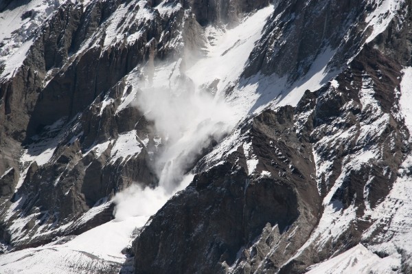
My intention was to set off early but I did not have a good sleep because of the altitude and moving was hard. It was already 9 am by the time I was ready to go. My daypack equipped with camera utensiles, something edible, water and rain jacket was quite comfortable to carry. Further up however, walking became strenuous again. Additionally, I experienced some headache, a clear sign that I was lacking acclimatisation. At Mirador I on 4000 m I met some people, and I learnt that from now on it was another hour walking to Plaza Francia. I felt flabby, my head was knocking while undertaking the slightest effort, but I decided to go on. Shortly after 2 pm I finally arrived. Since my water supply was very limited, I immediately started my way back and reached the camp at about 6 pm.
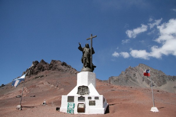
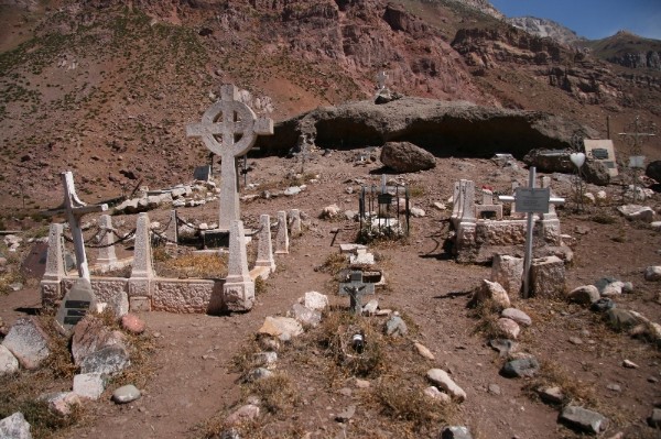
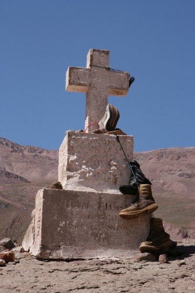
I started the day quite relaxed, it was only nine kilometers down to the park entrance. But very soon I had the feeling that I had lost a lot of energy, and those 24 kilos I still had to carry made things harder than I had thought. When I arrived at the park entrance I met two Argentinians who I knew from the camp, they had waited for me. They gave me a lift to Puente del Inca, where we had a snack. Then we drove up the old mountain pass to Cristo Redentor (remembering the peaceful settlement of the boundary dispute in 1902), afterwards visited the Aconcagua cemetery, and finally they gave me a ride back to Mendoza. After a short farewell they took off towards Buenos Aires.
Stand: 10.03.09 |
|||||||||||||||||||||||||||||||||||||||||||||||||||||||||||||||||||||||||||||||||||||||||||||||||||||||||||||||||||||||||||||||||||||||||||||||||