|
|
||
|
|
|
|
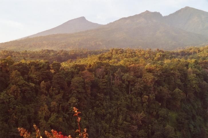
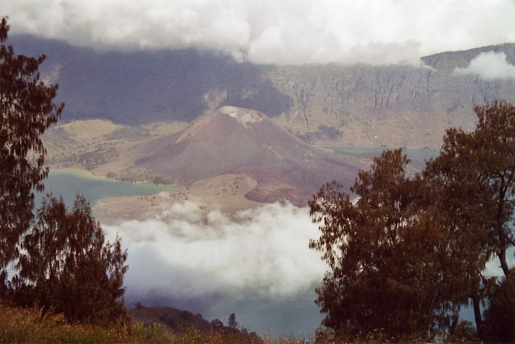
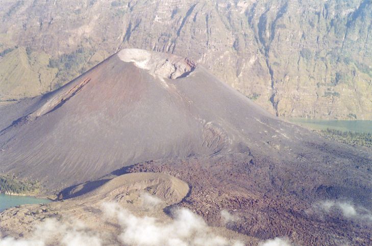
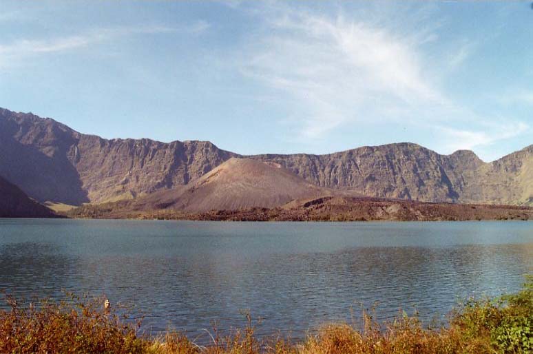
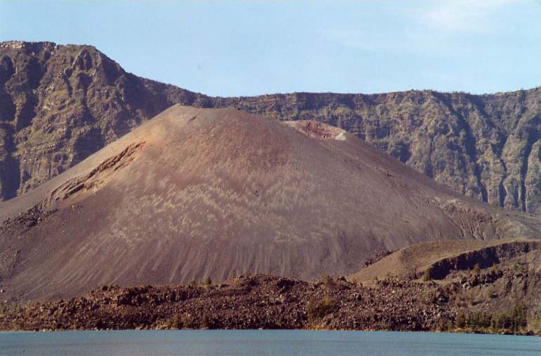
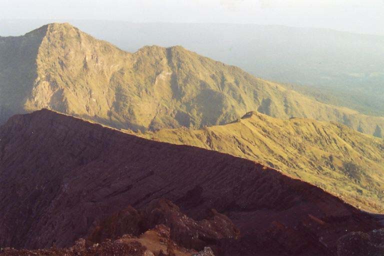
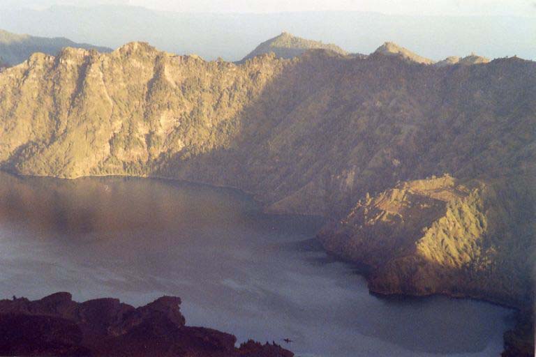
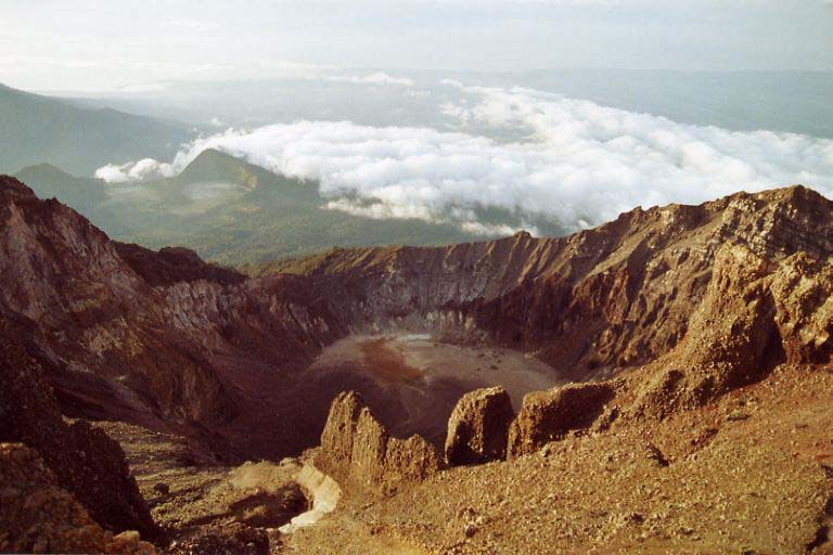
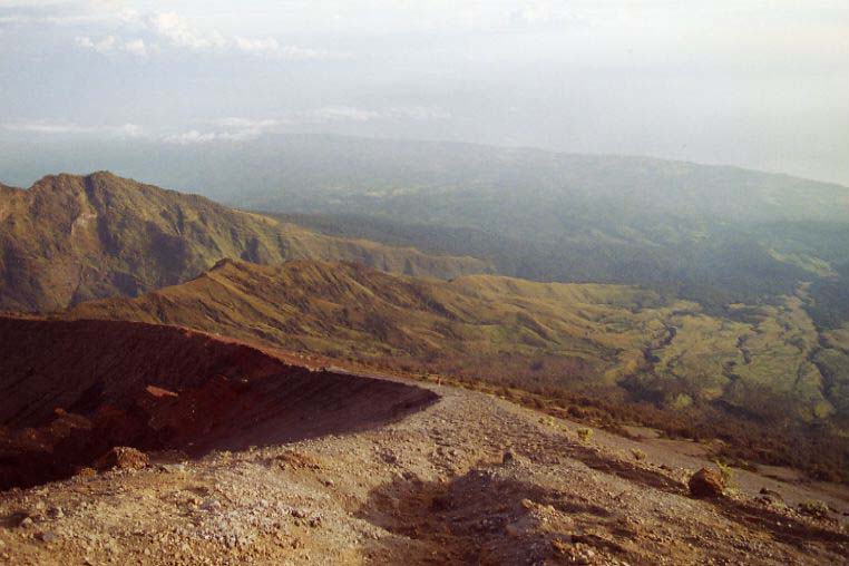
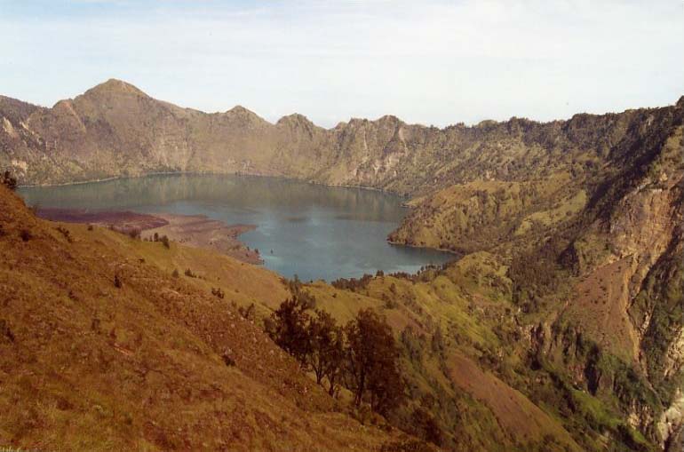
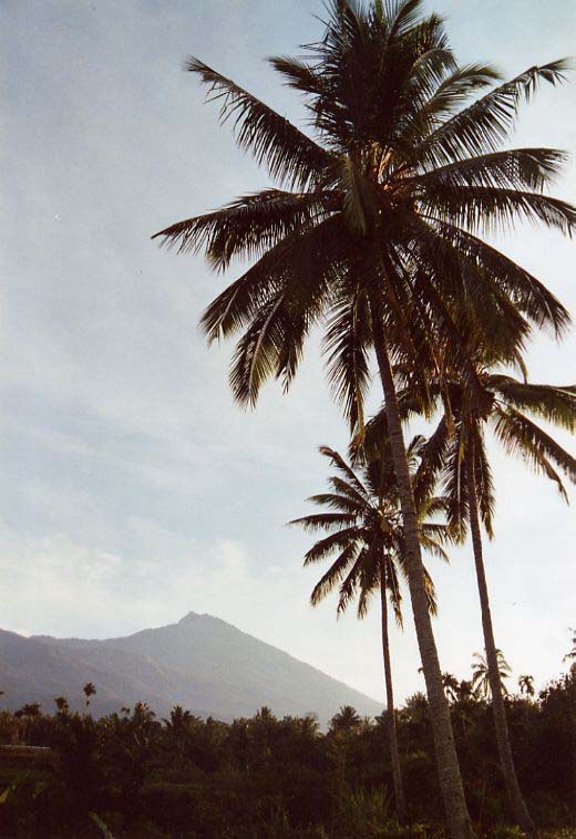
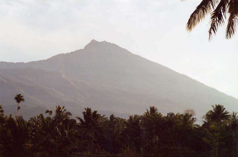
The volcano Rinjani at an altitude of 3726 m is the 3rd highest peak in Indonesia and stretches on the Northern part of Lombok island. During the past thousands of years a lake has built up in its Caldera with 6 km at the longest side and a new volcano -Gunung Baru, 2351 m - has emerged. The latest major eruption was in 2004. On the eastern end of the lake the peak rises enclosing another older crater. Beginning of May 2005: start from Padangbai harbour in the east of Bali, a little fishing village with a dock for the ferries to Lombok. The crossing took about three hours, during which Rinjani was never visible. The whole afternoon it had been covered in clouds and I had no impression of its real shape. We arrived in Lembar and transfered to Senggigi by van. This is probably the most developed place to cater tourists on Lombok besides the three little Gili islands. For your convenience you can already make your arrangements for Rinjani trekking here however, it is also possible to do it in Senaru, the starting point for the trek when commencing from the North side. Regarding prices all I want to say is compare and bargain, even if the trekking agencies try to convince you that their trekking association has set fixed rates and that there is no room for discounts. I had made the following arrangement in Senaru: three days trekking ending in Sajang on the eastern side of Rinjani (meanwhile the treks actually end there, not in Sembalun), and transfer to Tetebatu onnthe southside of the volcano. Total cost was about $ 140.00, including guide, porter, food supply and tent, all personal belongings carried by myself. Note: please insist that no wood is used as burning material in order to protect the forests. Unfortunately many locals and tour operators do not know much about the negative effects of deforestation, or they do not care about it. It is also possible to go without guide/porter however, food supply and cooking utensiles, tent and sleeping bag are essential. It is also advisable to watch out for guided persons and follow them when climbing the top at night and when going down to Sajang. Finally, I propose to do the trek from this starting point and not the other way around - even though it is a little bit tougher - but it also provides more spectacular impressions. The first view down on the lake from the northern crater rim is unbeatable. When you first look down from the east it is less impressive because you do not have the same overall view, and later from the north you would not experience the first site effect.
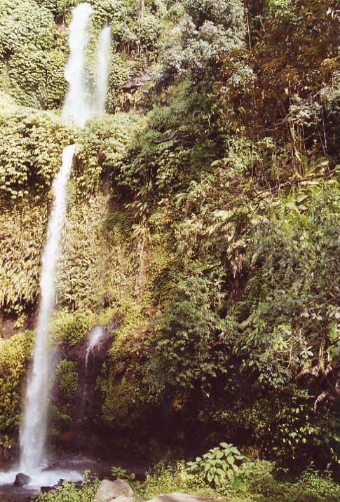
We started at 7:15 in the morning. The previous day I had a chance to take a glimpse at Rinjani peak when I wandered around at one of the two nearby waterfalls and between rice fields. It looked so close, so obviously should be a quite pleasant walk.
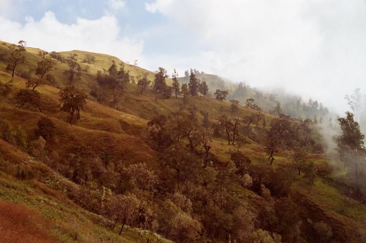
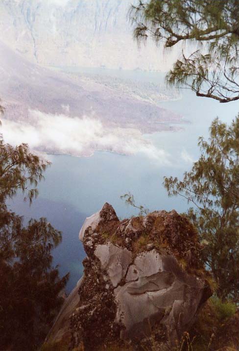
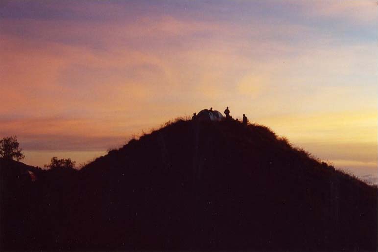
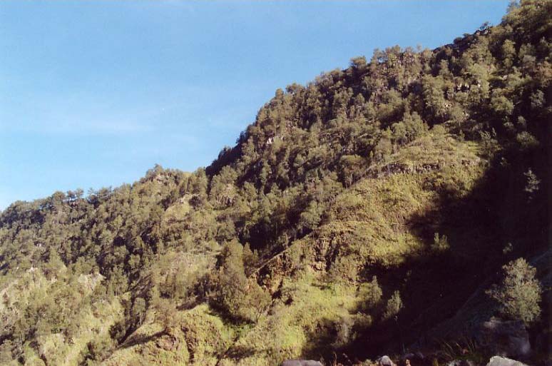
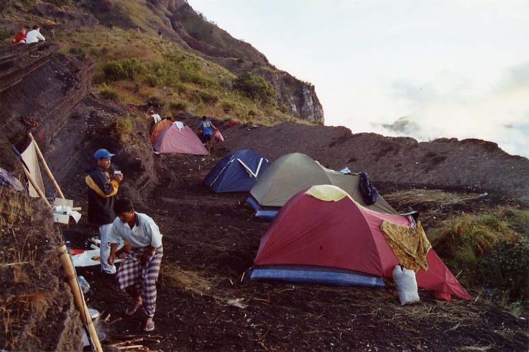
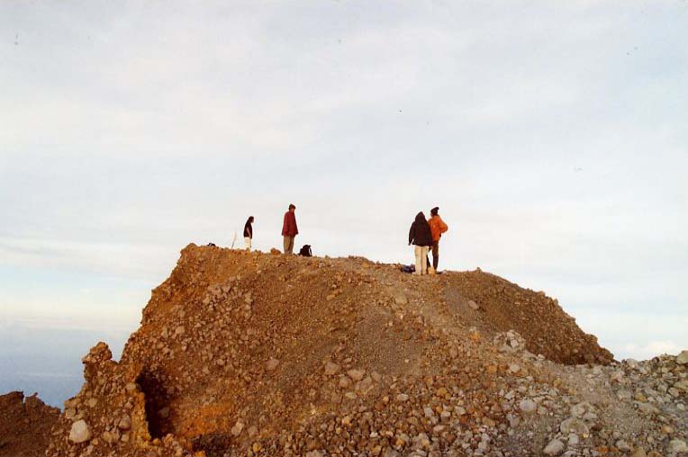
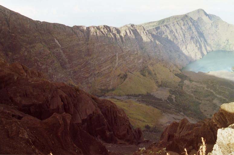
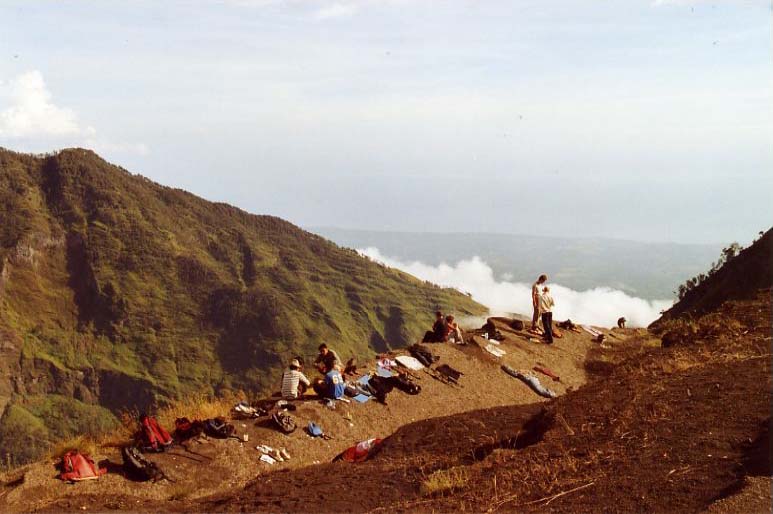
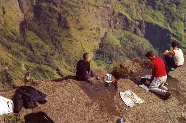
After I had paid the fee at the National Park entrance it went upwards comparibly smooth however, this changed soon when we entered the forest in order to walk straight up to the crater rim. We walked at good pace and felt that we were ready for a longer break when we arrived at Pos III on 2000 m at around 10:45 am. Up here the forest is more sparse, grass and fern dominates the scenerey more and more. A group of locals took a rest here as well, and they invited me to try their dishes. Together we prepared our lunch, and having eaten we gave our legs a rest for a while before we advanced to the crater rim. About 1 1/2 hours later we got rewarded for the effort: the first look down to the lake and Gunung Baru, this moment was indescribable. Roger Dean crossed my mind, who is known for his surreal music record cover pictures for "Yes", somehow this view resembled it. I walked back and forth looking for further picture perspectives and of course, for a location with good views where we would set up our tents. The tents were erected quickly and later I spent some time with Guenaelle and Franck from southern France (Pyrenees). I had first met them during the ferry trip from Bali to Lombok, and spent many good moments with them here and later on the Gilis.
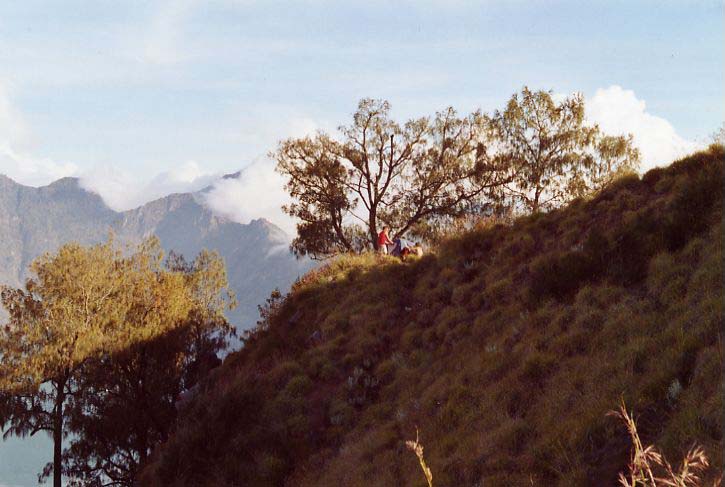
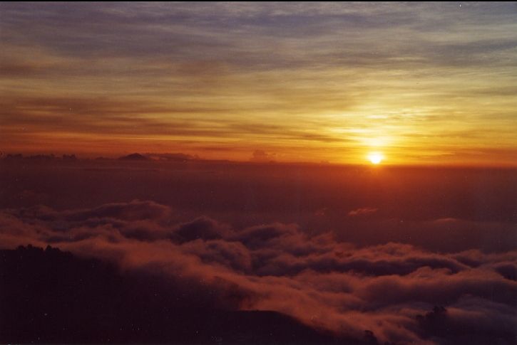
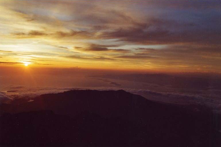
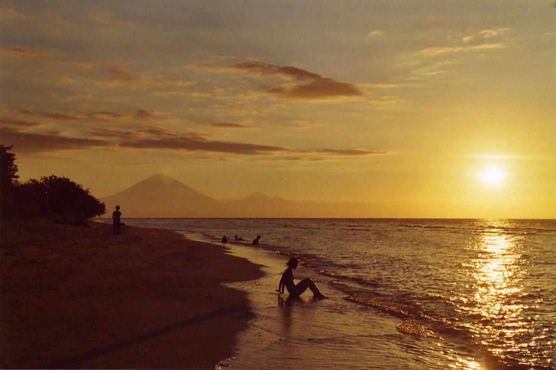
The obligatory sunset watching happened above a sea of clouds. Towering above them was only Gunung Agung, Bali's highest mountain at 3014 m.
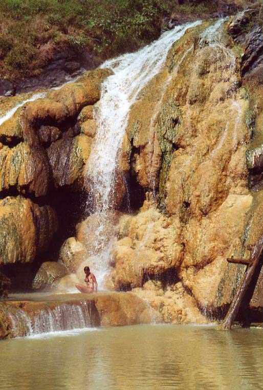
Start at 8:30 am. There is only one way downwards, and it commences after a little vertical climb down over rocks. The trail was easy to follow, and after one hour we arrived at the lake. It is only a little bit further along the lake to the camp site. Locals go for fishing and sell their catch on the village market. Of course it is possible to buy something in order to support the locals. I went on to thehot waterfall right away, 10 minutes away from the camp. A good oportunity to wash myself and my sweaty clothes. Afterwards, I relaxed in the natural pool getting myself a warmwaterfallbackmassage. Sometime later my French friends came, and a German father - much too voluminous, as he himself said. He did the two days walk with a guide and a porter, leaving his family behind at the beaches of Senggigi. In the morning he had started above Pos III, and his intention was to return all the way back to Sembalun after having enjoyed the bath. Kudos! if he has managed it.
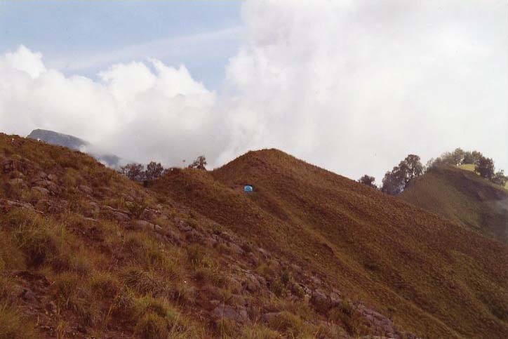
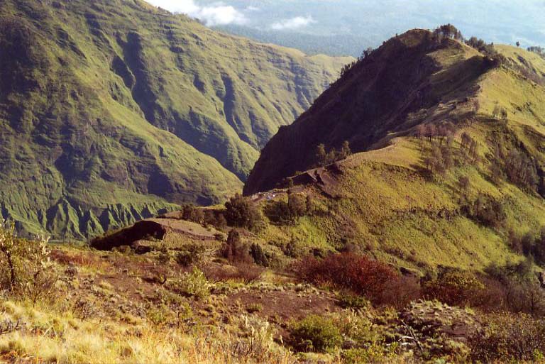
After lunch we went on at about 1.30 pm. We left the lake near the flank of its outlet, consequently went on walking outside the caldera, eastwards and upwards. Unfortunately, more and more clouds came in and eventually it started raining. First ther was just spray, then it rained harder which was quite uncomfortable because of increased winds. We arrived at around 3.30 pm. There was no view, Guena and Franck were suffering with me, waiting for better conditions before we started erecting the tents.
Later, I talked to my guide planning for the ascent in the night. In order to be on the top for sunrise, the summit should be reached before 6.00 am. Considering the 1000 m difference I would have given myself a time allowance of four hours, but he gave me three, only.
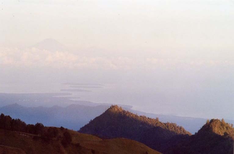
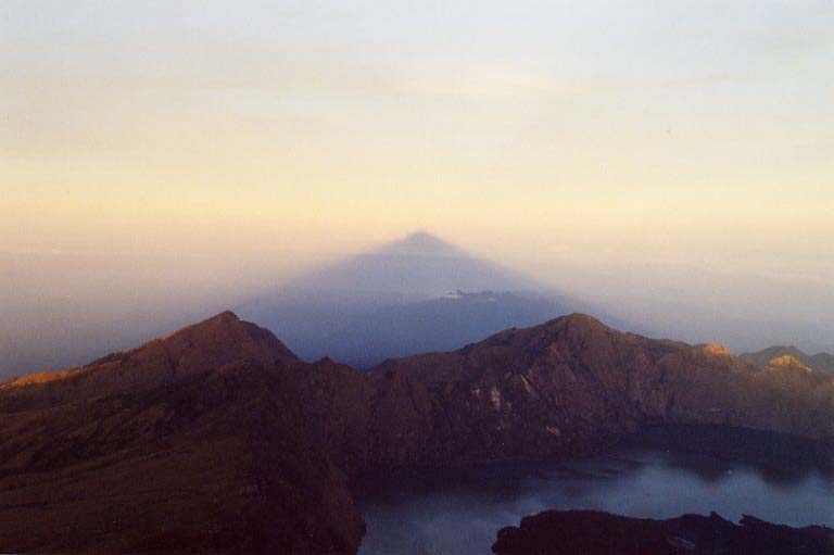
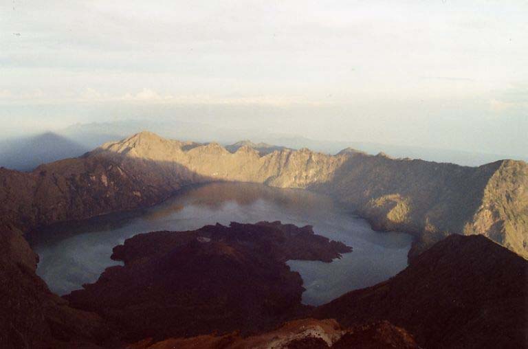
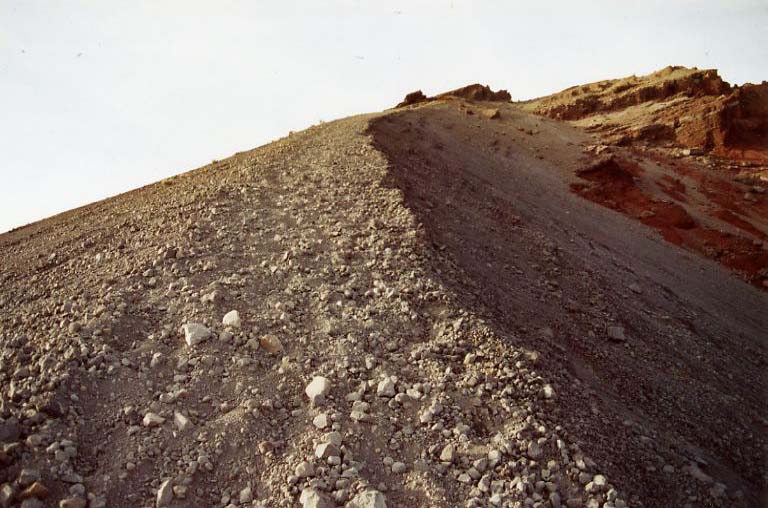
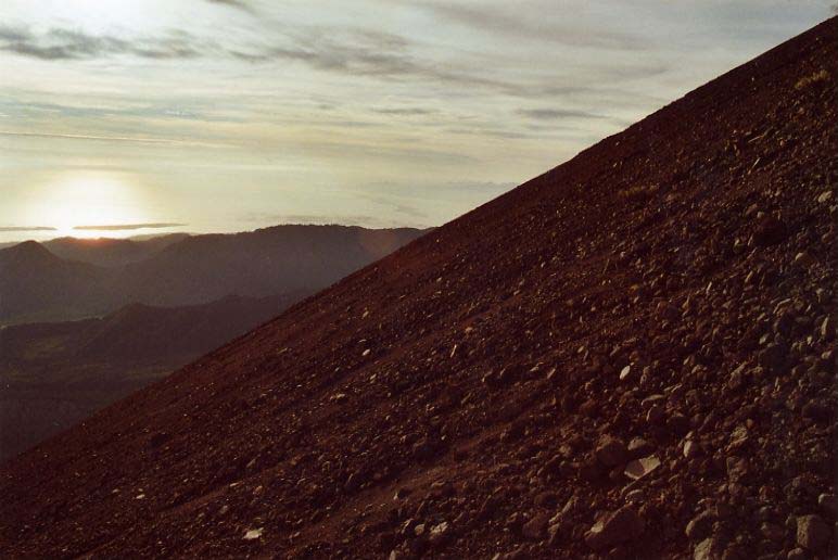
Getting up at 2.30 am, the backpack was already prepared, it was flipping cold below 0 C with winds. I put on several layers: with thermal underwear, sweatshirt, wind blocker, and a rain jacket I felt appropriately prepared. I took a little breakfast - tea bananas, cookies - and did some other business (later it's problematic). My guide however, was not in a hurry at all, in the end we left quite late at 3.15 am. My blood had just begun to circulate when I was already hit by the first ascent. For the first 45 minutes it went straight up on a hardly visible path. Half way I stopped, took off my sweater and gave it to the guide who was quite happy because he still felt cold, and the rain jacket I stowed in my backpack. Then I went on, breathing deeply and having short rests again and again. Finally, we reached the ridge leading to the top, and the ascent was much more pleasant. The travel guide book Lonely Planet says about the last 350 m ascent that it is probably easier to crawl on all fours. When the trail got steeper I thought that they had exagerated, that it was not as hard as they described it. Well, I had to learn that the last part was still ahead of us. When we came to that point I had to acknowledge that it was absolutely steep and wished to have a ladder. Stones on the trail made me fall over from time to time, and I sank deeply into the volcanic sand sliding down a little, no matter whether I walked or rested for a moment. My guide encouraged me saying that quite a few trekkers give up here, either with tears in their eyes or swearing loudly. But there are also others, and particularly there was Guenaelle: light weighted, tough and super fit. All of a sudden she appeared, passed me with a smile and so speedy as if I would walk towards her. With some distance Franck - mountain guide - followed, he looked a little bit exhausted. It was a sight for my sore eyes when he passed me. They had overslept and in the beginning had taken the wrong way. I asked my guide how far we were away from the top. Only twenty minutes, first this stimulated me but thinking it over it also meant that I had to walk for another twenty minutes. I nearly came to a mental breakdown. Finally on the top, five to six, and it was already much brighter. I felt a sense of pleasure. It was flipping cold again and the wind was blowing. I quickly put on my rain jacket, ate a little snack, each new arrival received a heartly welcome, and together we waited for the sunrise. With the sun rising, the summit threw its shadow over the lake and onto the clouds. What a spectacle, the view was absolutely gorgeous. The crater lake and Gunung Baru beneath us, slightly turning right there was the summit ridge, in the west Bali with Gunung Agung, in the east Sumbawa. I stayed one hour, again and again I enjoyed the view and the changing clouds, but when I felt hungry I realized I had to go down.
The descent was real fun. Sliding weightless through the volcanic sand. The way from the summit ridge down to the camp would have been a hard attempt, but my guide helped me out: we went on sliding and cornering through lava canals which were filled with lava pellets. We arrived at 8.30 am, had an extensive breakfast, the monkeys got their share, we dismantled the tents and then left towards Sajang.
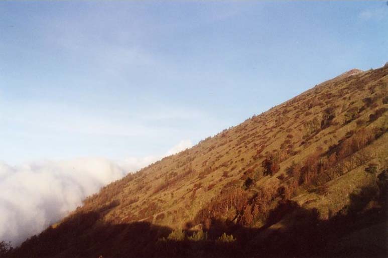
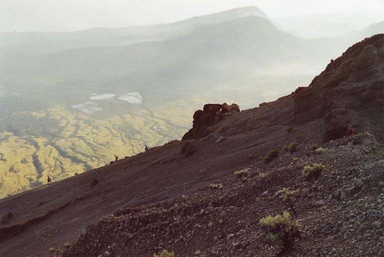
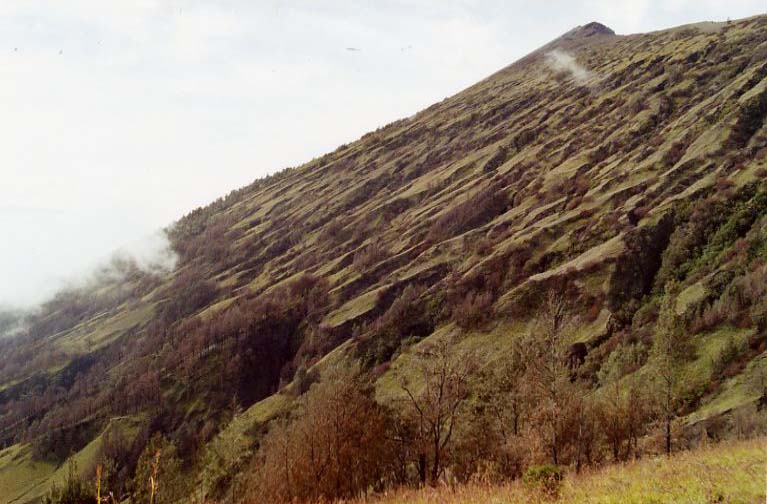
In the beginning the trail is a little steep, then gradually and through forest. Later the terrain became wider, and grassland dominated the scenery with head-high grass. After three and a half hours and nine kilometers we arrived in Sajang. The car which would take me to Tetebatu waited at the side of the road. I gave my guide and my porter a tip, then we altogether had some (expensive) beer on my expense, and eventually I arrived in Tetebatu.
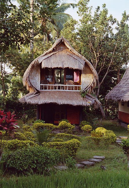
I had the choice which guesthouse to choose, there was no other tourist far and wide, which was the consequence of the Kuta/Bali bombing and current world politics. I had a bungalow surrounded with rice fields, a bed on the first floor, and on the ground floor the mandi with cold water. In the evening I sat on my balcony, reading and writing postcards. A cool beer would have been perfect, but unfortunately there was no beer available in the whole village.
The next day I hired a motorbike and drove through the region all day. I visited villages and their markets and eventually arrived in a weaving village called Pringgasela. I went into a shop, looked around, the manager took me to some private houses and showed me how they weave sarongs. I did not like to buy a sarong but had the idea that bedsheet covers would be something nice. It was hard to describe to him how I wanted it designed and we also could not agree how the business had to be carried out, therefore we agreed to cancel our business relation. In the evening, all of a sudden two men appeared in my guesthouse (they searched for me in several guesthouses), the manager and his shipping specialist. So we sat together again, I explained and drew sketches until they comprehended, and after hard bargaining - I love that - we came to an agreement. Five months later tha package finally arrived. One set natural indigo, the other one with synthetic colours. Both, bedsheet covers and pillow covers with buttons made of coconut shell. The price was $ 170.00, plus shipping, for nearly three months of handicraft. And you can see the result here. The next day I left and allowed myself some relaxing days with my friends on Gili Trawangarn.
Back to: Preface 1. Day 2. Day 3. Day Stand: 19.07.09 |
||||||||||||||||||||||||||||||||||||||||||||||||||||||||||||||||||||||||||||||||||||||||||||||||||||||||||||||||||||||||||||||||||||||||||||||||||||||||||||||||||||||||||||||||||||||||||||||||||||||||||||||||||||||||